Deutsch
 English
 中文
中文
 Danish
 Eesti
Eesti
 Español
 Suomi
Suomi
 Français
 Italiano
 日本語
日本語
 한국
한국
 Nederlands
 Norge
Norge
 Polski
 Portugues
 Русский
 Svenska
 Türkçe
 العربية
 Romanesc
 български
Contemporary witness to climate history
Geo adventure trail "Moving stones - moving climate"
The Geo-Adventure Trail takes visitors on a loop around Brelinger Berg, offering a journey through our region’s climate history spanning many thousands of years. Twelve thoughtfully designed stations explain how humans and nature have shaped the landscape and climate—and continue to do so today.

"Moving Stones – A Changing Climate" at Brelinger Berg
What does the Eiffel Tower have to do with the Ice Age? What do glaciers sound like? Where has the forest around Brelinger Berg gone? And how have humans shaped the climate since the last Ice Age? Using all your senses and a smartphone, a hike along the nature trail becomes a journey through the region’s climate history.
At twelve artistically designed stations, visitors can learn how Brelinger Berg was formed.
Built on Sand – A Journey Through Time on Brelinger Berg
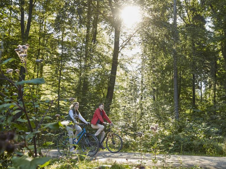
When you set out on the Geo-Adventure Trail from the Oegenbostel Cemetery and begin your 5.5-kilometer loop around Brelinger Berg, you’ll feel it right away beneath your feet: the fine sand that the glaciers of the penultimate glacial period of the Ice Age carried here some 230,000 to 200,000 years ago. You walk uphill on a soft, wide path—past colorful pebbles, black flint, and coarse and fine sand of all grain sizes. The glacier has done a thorough job: rocks were ground down, pushed, and smoothed. This is how—very slowly—an elevation was formed that today almost resembles a dune on the North Sea. A hill, shaped by ice, water, and wind. It smells of coniferous forest and fresh resin—almost like a vacation by the sea.
Suddenly, a deep cut opens up in the landscape to your left: You’re standing on a viewing platform above the sand extraction site, a massive open-pit mine. Sand has been extracted here for decades—a valuable raw material for home and road construction. And via your smartphone, you’ll learn why Brelinger sand is so sought-after in the construction industry—and why Sahara sand can’t replace it.
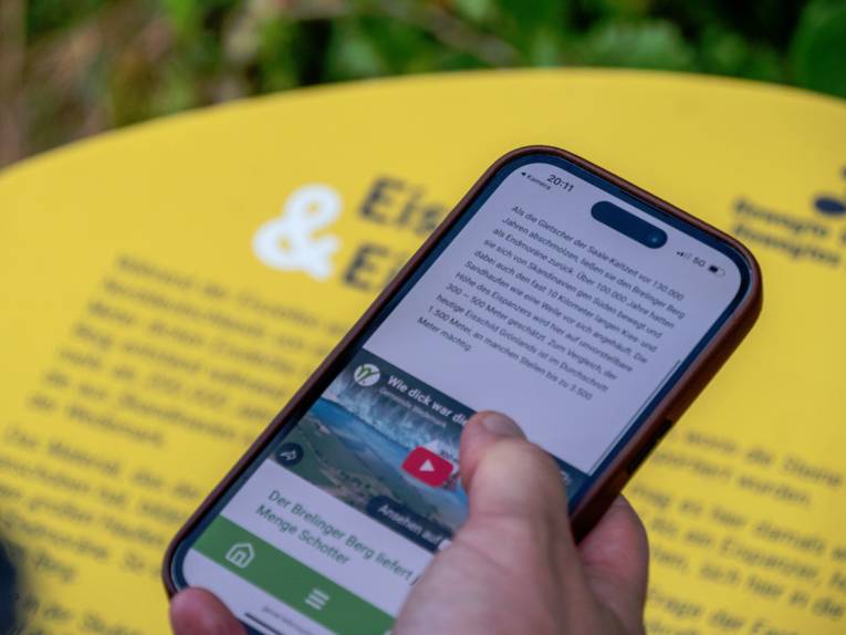
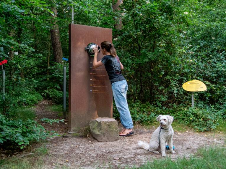
You can scan QR codes at each station on the geo adventure trail to access short films and illustrative graphics.
Touching allowed - history to experience
The deeper you venture into the mixed forest, the more the mountain’s history unfolds. At twelve artistically designed stations, you’ll learn how Brelinger Berg was formed—and how nature and humans have influenced each other over thousands of years.
You’ll blow fine sand over smooth wind-eroded edges, strike granite with a hammer, and hear the sound it makes. Together with friends, you’ll try to move a boulder along rails. You’ll learn to distinguish between different types of trees and experience the landscape with all your senses.
At each station, you can scan QR codes with your smartphone. These links to short videos, informative graphics, and concise texts that show you:
• how thick the ice was when the glacier towered over the mountain,
• how wind smooths rough stones into smooth wind-eroded edges—and what that has to do with NASA,
• and how humans have shaped the landscape of the surrounding Wedemark region for over 8,000 years—with noticeable consequences for vegetation and climate that persist to this day.
In 2–3 hours, you’ll get to know a fascinating landscape—and understand how it came to be.
A trail for all those who like to take a closer look - and want to experience how nature, people and the climate are connected. Event and opening dates: Click here for the geo adventure trail.
Discover all year round - with or without a guide
The geological trail is open year-round—perfect for family outings, exciting excursions, school trips, or special walks.
Your visit will be even more memorable with a guided tour led by geologist and paleontologist Dr. Kerstin Athen. With her expertise, humor, and surprising visual aids, she brings the history of the Earth to life.
Program flyer
The flyer with the schedule of guided tours of Brelinger Berg has just been published and is available at City Hall and MOORiZ, among other places. It can also be downloaded as a PDF from the municipality’s website at www.wedemark.de.