 Deutsch
 English
 中文
中文
 Danish
 Eesti
Eesti
 Español
 Suomi
Suomi
 Français
 Italiano
 日本語
日本語
 한국
한국
 Nederlands
 Norge
Norge
 Polski
 Portugues
 Русский
 Svenska
 Türkçe
 العربية
 Romanesc
 български
Always take it easy
Koldinger Lakes
Between Rethen, Gleidingen, Ruthe and Koldingen you will find something special.
Koldinger Lakes in Pattensen
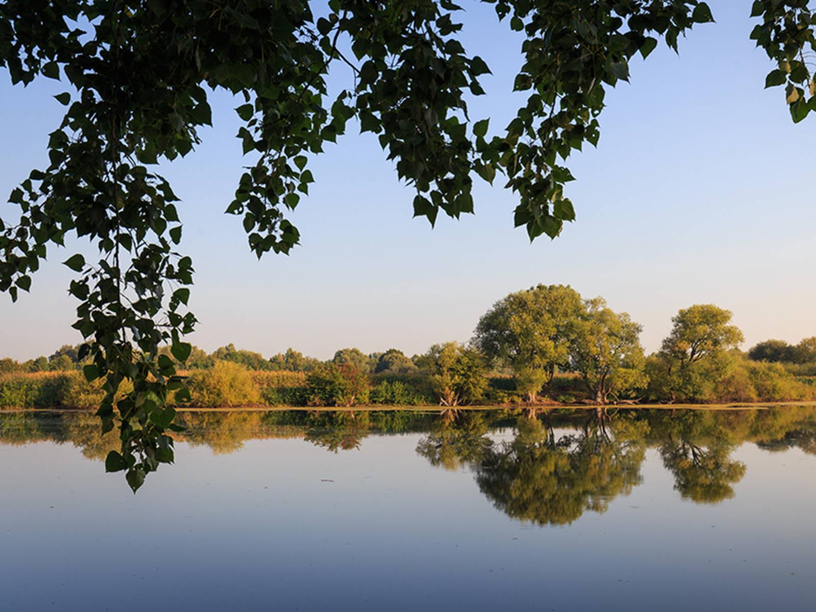
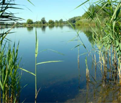
The Lakes of Koldingen in the Southern Leine Floodplain are something special and always worth a stroll. Vast expanses of water, green-lined shores, the honking of geese and the chirping of birds amidst restful silence. It takes a good hour to explore the area along the designated paths. It’s hard to imagine that, until just a few years ago, wheel loaders, bulldozers, and dredgers dominated the landscape in this idyllic setting.
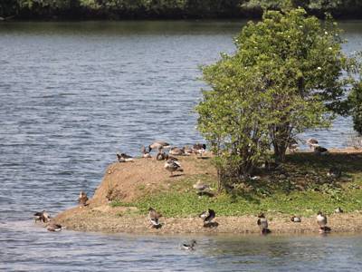
The Lakes of Koldingen are a secondary habitat. They were created by intensive soil extraction. For over 40 years, gravel and sand were mined here and processed into high-quality aggregates for the construction industry. The result: approximately 190 hectares of water, spread across a dozen or so lakes. Due to its great importance for flora and fauna, especially for birdlife, the lake landscape has been a protected nature reserve since 2001. Alongside the Steinhuder Meer, it is the most significant bird resting area in the region.
To make the area accessible, walkable, and enjoyable for visitors, the Region Hannover has, among other things, created a circular hiking trail around the Großer Koldinger See, built an observation tower on its western shore, and established a north-south trail connection toward Ruthe, along which Route 15 of the FAHRRADREGION HANNOVER runs from the Maschsee through the Südliche Leineaue.
The Lakes of Koldingen can be reached by bus and train via the stops Rethen (Leine) Kiesgrube, Gleidingen Orpheusweg, Gleidingen Thorstraße, and Ruthe Friedhof. For more information, please visit www.gvh.de |
The Kolding Lakes
The Kolding Lakes
Description of the Lakes of Koldingen habitat and a brief overview of its history
File type: pdf Size: 612,89 kB
Map of the Koldinger Lakes
Map of the Koldinger Lakes
Map of the Lakes of Koldingen with information on the habitat (as of April 2007)
File type: pdf Size: 756,61 kB
The southern Leine floodplain
The southern Leine floodplain
Scenes from the southern Leine floodplain, brief description of the Lakes of Koldingen, brief description of Route 15 of the FAHRRADREGION Hannover cycling region with a schematic map
File type: pdf Size: 408,32 kB

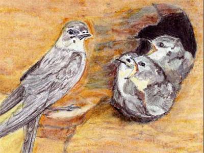
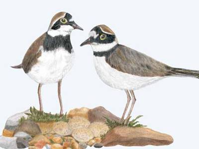
The bird species at the Großer Koldinger See
The bird species at the Großer Koldinger See
Birdwatching: Breeding and migratory birds at the Lakes of Koldingen
File type: pdf Size: 429,72 kB

Sewage pond habitat - a piece of inland mudflats
Sewage pond habitat - a piece of inland mudflats
The Function of Clarification Ponds (or Stacking Ponds) and Their Importance to the Lakes of Koldingen Ecosystem
File type: pdf Size: 428,63 kB
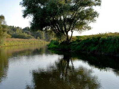
The Leineaue – between Ruthe and Koldingen
The Leineaue – between Ruthe and Koldingen
Nature Reserve in the Region Hannover: Located in the southern part of the Region Hannover is the 529-hectare nature reserve “Leineaue zwischen Ruthe und Koldingen” (N...
File type: pdf Size: 3,13 MB
The Leine: Lifeline, Greenway, and Hiking Route
The Leine: Lifeline, Greenway, and Hiking Route
The steep face and sediment habitats, "The supporting pillars" in the nature reserve
File type: pdf Size: 470,95 kB
Gravel and sand banks
Gravel and sand banks
Dynamic habitats of a floodplain (flora and fauna)
File type: pdf Size: 704,24 kB
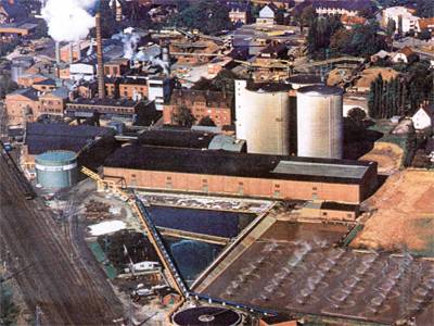
The Rethen sugar factory
The Rethen sugar factory
History of the site and the importance of the stacking ponds for nature conservation
File type: pdf Size: 587,86 kB