 Deutsch
 English
 中文
中文
 Danish
 Eesti
Eesti
 Español
 Suomi
Suomi
 Français
 Italiano
 日本語
日本語
 한국
한국
 Nederlands
 Norge
Norge
 Polski
 Portugues
 Русский
 Svenska
 Türkçe
 العربية
 Romanesc
 български
Active on foot
Hiking Trails in the Deister
Here you will find the most beautiful hiking routes through the mountain range at the gates of the state capital as downloads.

Pure nature: Hiking and biking in the Deister
The Deister mountain range dominates the landscape of the Calenberger Land region. Located just outside the state capital and easily accessible by S-Bahn even without a car, this 405-meter-high range is perfect for both leisurely and challenging hikes.
The varied landscape and cultural areas are ideal for hikers of all ages and abilities. The trail is a rewarding destination that hikers, walkers and cyclists can discover all year round. You can download tips and information on the most beautiful routes below.
You can find the new fold-out map "Walking Through the Deister" here
Hiking in the Deister - Download:
Hiking Tips for the Deister
Hiking Tips for the Deister
Here you will find hiking tips to download in practical PDF format.
File type: pdf Size: 7.38 MB
Stamp Fun in the Deister
The Deister Hiking Pass
The Deister is perfect for hiking: Stretching about 20 kilometers long and four kilometers wide, this mountain range—which rises to a height of 404 meters—lies about 30 kilometers southwest...
read

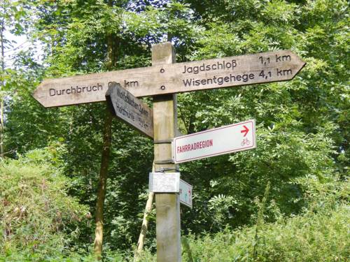
Hiking in the Deister
On the E1 through the Deister
You can hike about 30 kilometers through the Deister on the E1 trail, giving you a taste of this roughly 8,000-kilometer-long hiking route.
read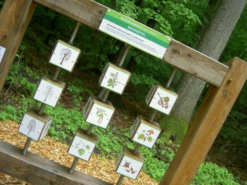
Active in the Deister
Forest Nature Trail and Nature Puzzle Trail
Hiking with fun - discover the forest, wildlife and nature in a variety of ways!
read
Active in the Deister
Hike to the mountain huts in the Deister
Hiking fun from the Wennigser Mark to Bredenbeck or to the Steinkrug.
readActive in the Deister
A hike through the Deister Mountains off the beaten path
Just before the regional border, right on the edge of the Kleiner Deister, lies the Springer neighborhood of Altenhagen I—the starting point for a nearly 18-kilometer-long...
readTourist Info Icon
30159 Hannover